UgCS
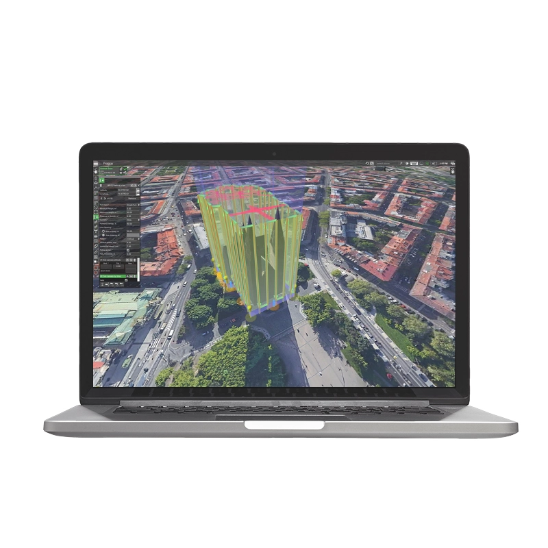
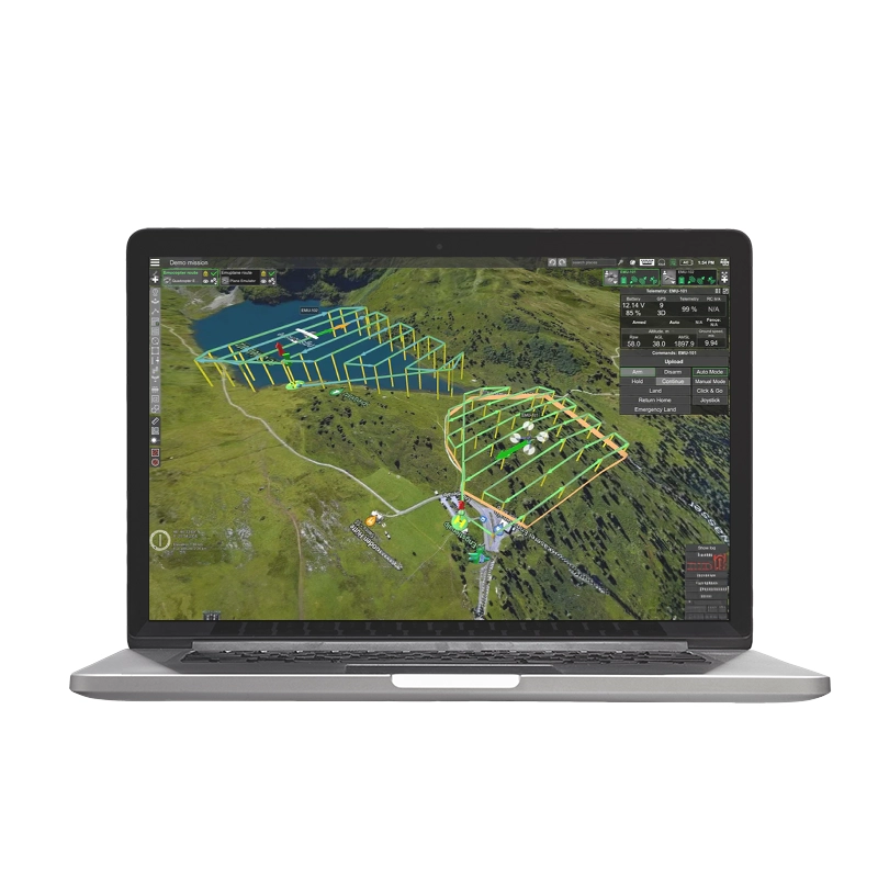
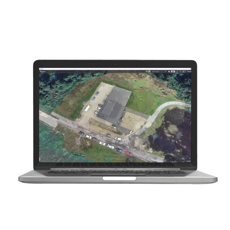
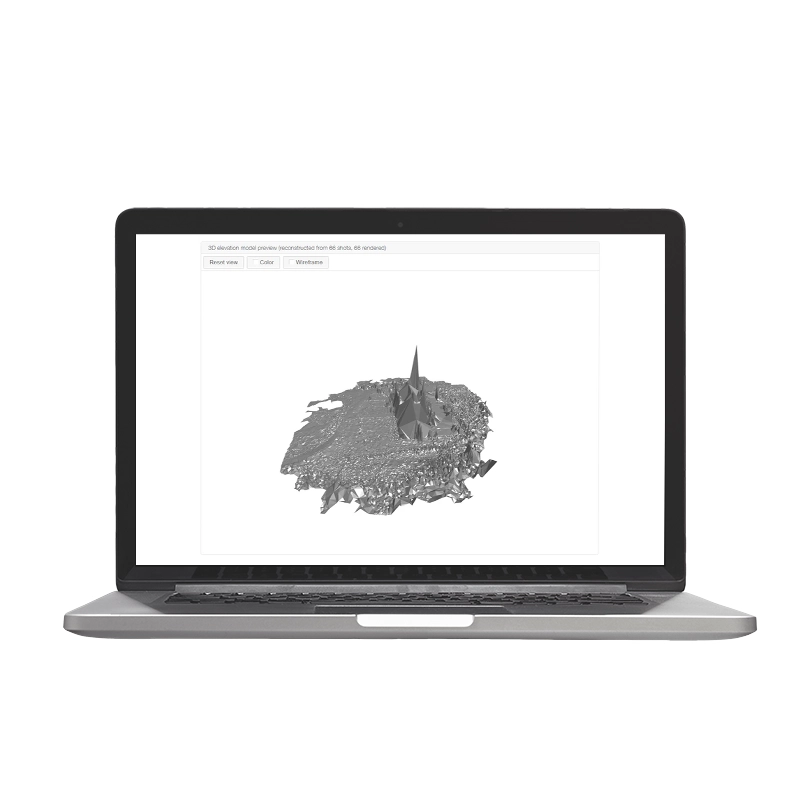
UgCS is advanced software for drone mission planning and control. It supports photogrammetry, LiDAR and aerial scanning, optimizing professional operations. Compatible with various payloads, it offers an intuitive interface for automated missions.
From 890,00 € TAX Included
Limited stock – Shipped in 24-48 h
UgCS
An all-in-one software for automatic flight planning with advanced functions for every field of application and compatible with most drones and sensors on the market. UgCS software enables automatic flight mission planning via a 'graphical user interface complete with functions for aerial photogrammetry and Lidar scans.
The UgCS PRO license is designed for professional drone pilots and service providers. It has all the main UgCS features listed below with the exception of LiDAR flight planning tools (available in UgCS EXPERT) and video streaming and multi-node distribution (available in UgCS ENTERPRISE).
Find out why UgCS is the best choice for professional drone pilots worldwide.
Choose the UgCS license that best suits your types of flights and tasks | | | |
Route creation from KML / CSV files | |||
Exporting routes in KML | |||
Terrain following | |||
Customisable map | |||
Corridor inspections | |||
Vertical flight planning | |||
Go Offline | |||
Smart AGL | |||
LiDAR tool | |||
Live video streaming | |||
Up to 10 simultaneous drone connections | |||
Share your missions with the team | |||
UgCS SDK |
Supported Drones
Supports most popular UAV platforms including DJI M300/350, M600, M2X0, Inspire, Phantom series, Mavic series; MAVLink compatible drones (Pixhawk with ArduPilot/PX4).
UgCS Perpetual License
Buy once, own forever The first year of support and updates is included. Starting in the second year, you must purchase an annual support and updates package to access the latestsupport and updates.
System Requirements
| OS | Windows | macOS |
|---|---|---|
| Operating system | Windows 10; Windows 11* 64-bit | macOS: 10.13 High Sierra or later* 64-bit |
| CPU | Core 2 Duo or Athlon X2 at 2.4 GHz | Core 2 Duo or Athlon X2 at 2.4 GHz |
| Memory | Recommended: 8 GB of RAM | Recommended: 8 GB of RAM |
| Hard drive | 2 GB of free space | 2 GB of free space |
| Graphics hardware | Graphics card with DirectX 11 support (shader model 4.0). Any card made since 2004 should work | Graphics card with DirectX 11 support (shader model 4.0). Any card made since 2004 should work |
| Network | TCP/IPv4 network stack | TCP/IPv4 network stack |
| Screen resolution | Minimum supported screen resolution: 1920x1080 | Minimum supported screen resolution: 1920x1080 |
Call Us Now
for a free consultation on Hardware,
Software, and ENAC.
Book Now
your free phone consultation with our Experts.
Based on 0 reviews
Be the first to review “UgCS” Cancel reply
Related products
- Georadar, Georadar & Magnetometer Combo, UgCS - SPH
Georadar Drone - Zond Aero 500 NG
0 out of 5(0)The Zond Aero 500 is an ultralight, single-unit ground penetrating radar (GPR) system specially designed for portable solutions. Compatible with DJI Matrice 300 and 350 drones, this georadar offers advanced performance for geophysical and archaeological survey applications.
SKU: n/aFrom 21.959,00 € TAX IncludedThis product has multiple variants. The options may be chosen on the product page - Georadar, Georadar & Magnetometer Combo, UgCS - SPH
Georadar Drone - Zond Aero 1000 NG GPR
0 out of 5(0)The Zond Aero 1000 is an ultralight, single-unit ground penetrating radar (GPR) system specially designed for portable solutions. Compatible with DJI Matrice 300 and 350 drones, this georadar offers advanced performance for geophysical and archaeological survey applications.
SKU: n/aFrom 24.399,00 € TAX IncludedThis product has multiple variants. The options may be chosen on the product page


There are no reviews yet.