DJI Terra Electricity Overseas 1 year (1 device)
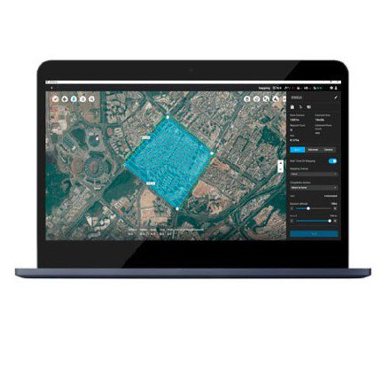
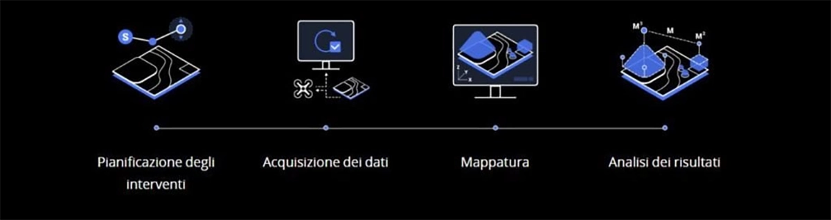
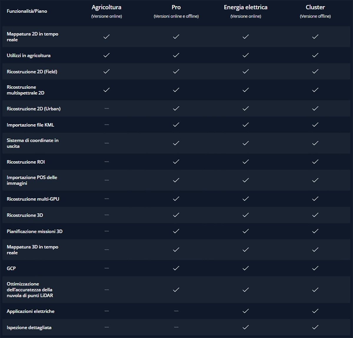
DJI Terra Electricity Overseas 1 year (1 device) Supports cluster processing mode Multiple computers perform calculations simultaneously, significantly improving efficiency, suitable for large-scale reconstructions. Requires purchase of cluster version license for use. Supports processing of the Lidar point cloud collected by ZENMUSE L1.
3.177,00 € TAX Included
Limited stock – Shipped in 24-48 h
The world, your digital resource.
Photograph, analyze and visualize the environment around you with DJI Terra, practical mapping software developed to assist professionals in transforming real images into digital assets.

Plan. Processes. Analyze. Execute.

Digitize your world
Public Safety
Speed and efficiency for on-site acquisition of critical information.
Construction
Accurate collection, measurement, and analysis of data on each project.
Infrastructure
Perform detailed inspections of structures and in complex scenarios with ease.
Agriculture
Accurate evaluation of cultivated land to maximize yield.
Cinematography
Optimized pre-visualization to improve the organization of filming.
Mission planning
Waypoints
Planning with route points
Create effective flight paths using predefined route points and the ability to adjust parameters such as altitude, speed, camera angle, aircraft orientation and more.
For more elaborate and complex missions, which require extreme accuracy, the 3D flight visualization function allows missions to be designed and simulated on the three-dimensional models created.
Area
Planning an area
With just a few touches on the screen, you can automate complex missions to continue capturing images and creating maps and models that will help you assess situations and make more thoughtful decisions.
Oblique
Oblique planning
For the most sensitive missions, when accuracy of information is critical, you can tilt the camera with the Oblique mode to get more detailed images and build an extremely faithful 3D model.
Mappings
Real-time mappings
Real-time mapping quickly creates orthomosaics without interrupting flight. Perfect for remote routes and quick interventions where time is crucial.
2D Reconstructions
High-resolution orthomosaics with detailed and accurate measurements for the most delicate projects.
3D Reconstructions
Clear and realistic reproductions of the surrounding environment for a variety of industrial applications, such as accident reconstruction, site supervision for large-scale projects, and more.
Data analysis
2D and 3D measurements

Acquire dimensional information on different types of soils using practical analysis tools to process data based on linear, surface, and volumetric measurement values.
Annotations
Set and edit measure labels on existing templates to compile reports and facilitate communication between teams during project execution.
Photographic inspection
It inspects every detail reported in the model, selecting and highlighting critical elements present in the actual scene.
Both 3D models and photographic data allow objects to be inspected and their details to be compared.
Uninterrupted connection with your fleet of DJI drones
DJI Terra is compatible with the following models in the Phantom 4 series:
Phantom 4 RTK,
Phantom 4 Pro V2.0
Phantom 4 Pro+ V2.0
Phantom 4 Pro
Phantom 4 Advanced and Phantom 4
A new generation of mapping solutions begins
Harness the power of AI mapping solutions to take your industrial projects to new levels. Whether for object classification, site inspection, or other types of operations, jumpstart the development of mapping solutions and accomplish missions without difficulty.
- Data acquisition: Define your goal, set the desired flight plan, and, in a few touches, collect the data you need to achieve the desired result.
Data processing: Uses sophisticated image recognition technology to generate 2D and 3D data, resulting in a more realistic representation of structures, objects, scenery, and more.
Data use: Applies computer learning tools and techniques for use in various industries, such as classification algorithms to identify trees, objects and other environments.
Execution: Take the necessary measures and benefit from more efficient processes with computer control, be it automatic spraying operations, job monitoring, material transport, or much more.
DJI Terra License Plans

Call Us Now
for a free consultation on Hardware,
Software, and ENAC.
Book Now
your free phone consultation with our Experts.
Based on 0 reviews
Show only reviews in English (0)
Be the first to review “DJI Terra Electricity Overseas 1 year (1 device)”
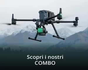
 Cancel reply
Related products
- Delivery System, DJI Matrice 350 RTK series
Delivery Dropping Kit DJI Matrice 350 with Camera - 4 Loads
Delivery System, DJI Matrice 350 RTK seriesDelivery Dropping Kit DJI Matrice 350 with Camera - 4 Loads
Rated 5.00 out of 5(1)The Delivery Dropping Kit for DJI Matrice 350 with camera supports up to 4 loads, offering precision and control during delivery and rescue operations. Easy to install, it provides reliable performance under a variety of operating conditions.
SKU: DB-4DK300TFrom 919,00 € TAX IncludedThis product has multiple variants. The options may be chosen on the product page - DJI Matrice 350 RTK series
Carts with DJI Matrix Light 350 - 8000LM/80W
0 out of 5(0)The Matrix Light for DJI Matrice 350 offers powerful illumination of 8000LM and 80W, providing visibility up to 300 meters. Perfect for night inspections, search and rescue, and low-light missions.
SKU: DB-FT350-1799,00 € TAX Included - DJI Matrice 350 RTK series, Spotlight
PTZ Spotlight DJI Matrice 350 - 6000LM/60W - 250mt
0 out of 5(0)The PTZ spotlight for DJI Matrice 350 offers powerful illumination of 6000 lumens and 60W, providing optimal light up to 250 meters. Ideal for night missions, inspections, and search and rescue operations, it ensures clear visibility and precise illumination in all conditions.
SKU: DB-SL3502.369,00 €2.399,00 €TAX Included - DJI Matrice 350 RTK series
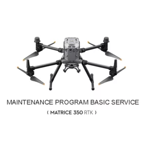
DJI M350 RTK Maintenance Program Basic Service
0 out of 5(0)[Maintenance service] is a service program launched by DJI that covers basic inspection, upgrade and calibration, deep cleaning, and replacement of easily worn parts and critical components. DJI also provides official maintenance reports.
SKU: DJM365660,00 € TAX Included - Air Water & Gas Sensors, DJI Matrice 350 RTK series
CH4 Laser Sensor for Methane Detection
Rated 5.00 out of 5(1)The CH4 Laser Sensor for Methane Detection is designed for the DJI Matrice 350 drone. It offers high accuracy and reliability, enabling efficient aerial monitoring of methane gas leaks, ideal for industrial and environmental applications.
SKU: LS-CH436.499,00 € TAX Included


There are no reviews yet.