

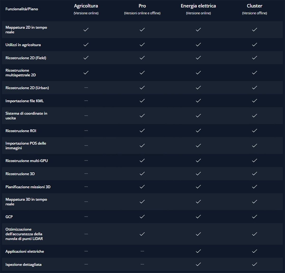
DJI Matrice 350 RTK series, DJI Mavic 3 Multispectral, DJI Terra, Drone DJI Mavic 3 Enterprise, Software
DJI Terra Pro Overseas Perpetual (1 device)
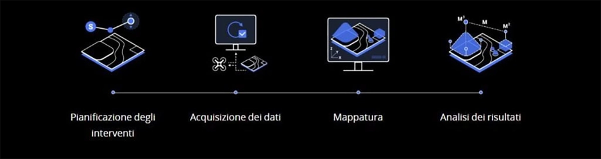
The world, your digital resource Action planning Data acquisition Mapping Data analysis
4.437,01 € TAX Included
Tuo da € al giorno con Noleggio Operativo
Disponibile su MEPA con codice:
SKU: DJET01


Based on 0 reviews
Show only reviews in English (0)
Be the first to review “DJI Terra Pro Overseas Perpetual (1 device)”
Related products
- DJI Matrice 350 RTK series, Drone DJI Mavic 3 Enterprise
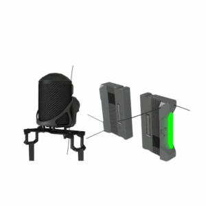
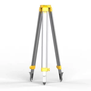
DJI D-RTK 2 Base Tripod Station
The DJI D-RTK 2 Base Tripod Station provides a stable and accurate base for the RTK positioning system. Designed for maximum accuracy and stability, it is ideal for high-precision mapping and surveying applications. Optimize your RTK experience with a rugged and reliable station.
SKU: DJE178 - DJI Matrice 350 RTK series, Spotlight
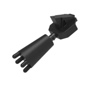
PTZ Spotlight DJI Matrice 350 - 6000LM/60W - 250mt
The PTZ spotlight for DJI Matrice 350 offers powerful illumination of 6000 lumens and 60W, providing optimal light up to 250 meters. Ideal for night missions, inspections, and search and rescue operations, it ensures clear visibility and precise illumination in all conditions.
SKU: DB-SL350


There are no reviews yet.