
Efficiency through flexible full-frame photogrammetry
The new benchmark for aerial surveying
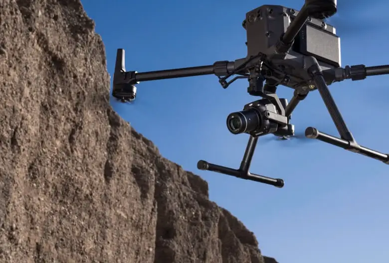
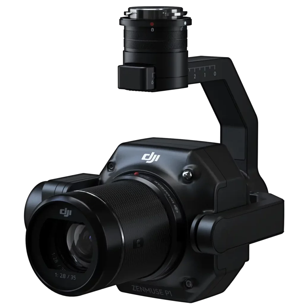
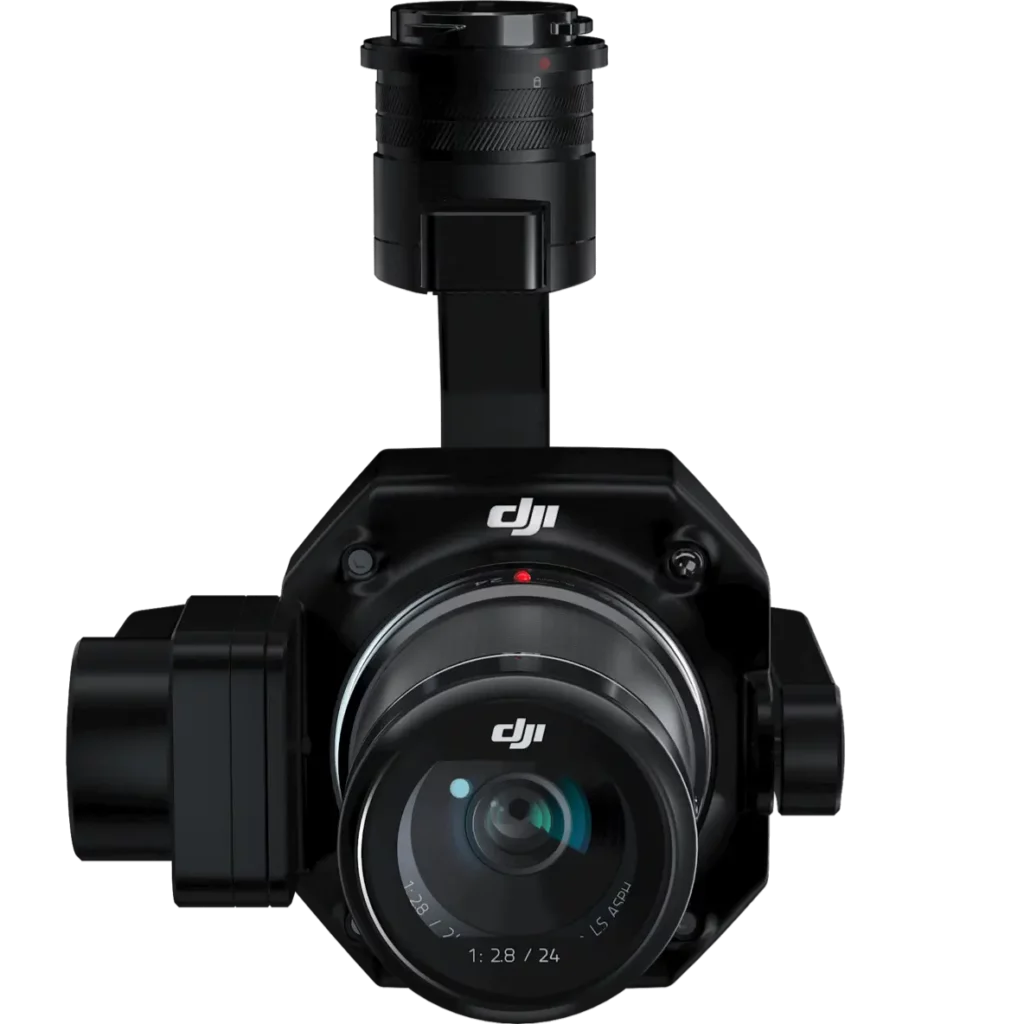
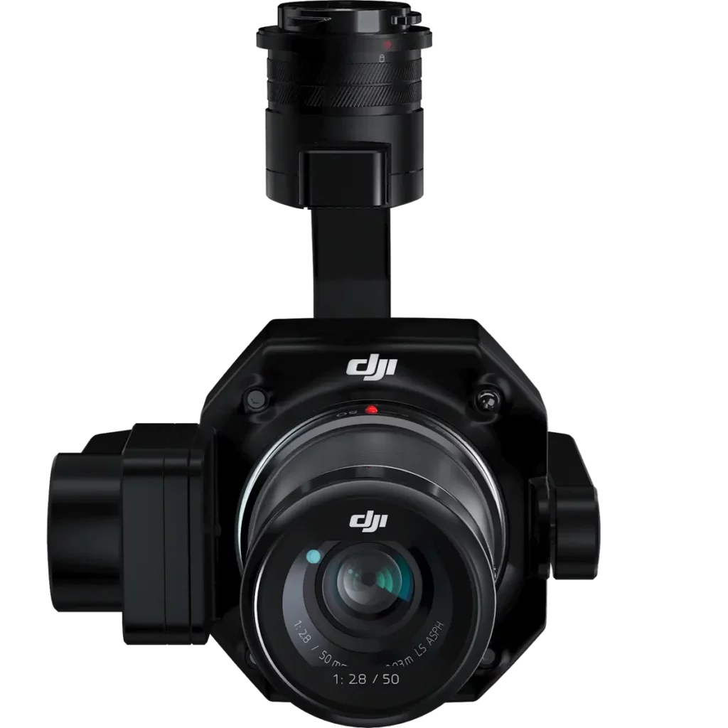
Zenmuse P1 integrates a full frame sensor with fixed focus interchangeable lenses on a 3-axis stabilizer. Designed for photogrammetry missions, it will bring efficiency and precision to a whole new level.

Accuracy without GCP 3 cm horizontally/5 cm vertically

High efficiency 3 km2 covered in a single flight

45 MP full-frame sensor

Smart Oblique Capture 3-Axis Stabilized Gimbal

Global mechanical shutter Shutter speed 1/2000 seconds

TimeSync 2.0 - Microsecond level synchronization
Your reference tool for aerial photogrammetry
Extraordinary efficiency
The P1 includes a full-frame, high-sensitivity, low-noise sensor that can take a photo every 0.7 s during flight and cover 3 km2 [2] in a single flight.
Extraordinary precision
Equipped with a global mechanical shutter and the brand new TimeSync 2.0 system, which synchronizes time between modules at the microsecond level, Zenmuse P1 enables users to capture centimeter-accurate data combined with real-time position and orientation compensation technology.
Solid versatility
Create 2D, 3D and detailed models with the built-in 3-axis gimbal that can be equipped with 24/35/50 mm lenses and the Smart Oblique Capture function.
Efficiency for complete detection
Full-frame camera
- 45 MP full-frame sensor - 4.4 μm pixel size - Low-noise, high-sensitivity imaging extends daily operating time - Takes a photo every 0.7 s during flight - TimeSync 2.0 aligns the camera, flight controller, RTK module and gimbal at the microsecond level

Flexibility to capture everything
More fixed focus lens options
- Global mechanical shutter, shutter speed 1/2000 seconds
- Sends median exposure pulse in microseconds
- Supports 24/35/50 mm lenses with DJI DL mounts
Work fast, work smart
Smart Oblique Capture
Cover 7.5 km2 in a single working day with the P1. Increase the efficiency of your oblique photography mission by using Smart Oblique Capture, in which the gimbal automatically rotates to take photos at the different angles needed. Only photos essential for reconstruction are taken at the edges of the flight area, thus increasing post processing efficiency by 20% to 50%[
Intelligent data management
Managing your mission data has been simplified.
Mission result files are automatically associated with the name and time of the mission.

A centralized storage location for photos, GNSS data and TimeStamps.MRK files.
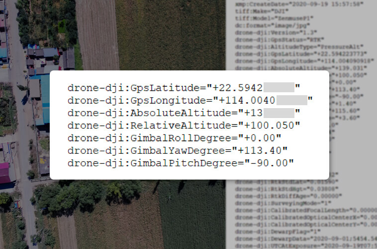
The image metadata contains the intrinsic and extrinsic parameters of the camera and the RTK status.

Fieldwork report
Verify data quality immediately after flight by checking position data and the number of images acquired, as well as RTK status and positioning accuracy.
A mission mode for any scenario
2D Orthomosaic Mission
Mission Oblique 3D
Detailed Mission Modeling
Generates orthomosaics without GCP using P1, perfect for medium to large area operations.
Effortlessly capture oblique images from multiple angles that meet 3D modeling requirements in areas such as urban planning and centimeter-accurate cadastral surveys for 3D reality models and smart city planning.
Acquire ultra-high-resolution image data of vertical or sloping surfaces from a safe distance that faithfully recreates textures, structures, and fine features for detailed reconstructions, geological surveys, historic site preservation, hydraulic engineering, and more.
Application scenarios
Topographic mapping
Acquire data that meet the accuracy requirements of 1:500 scale without GCP.
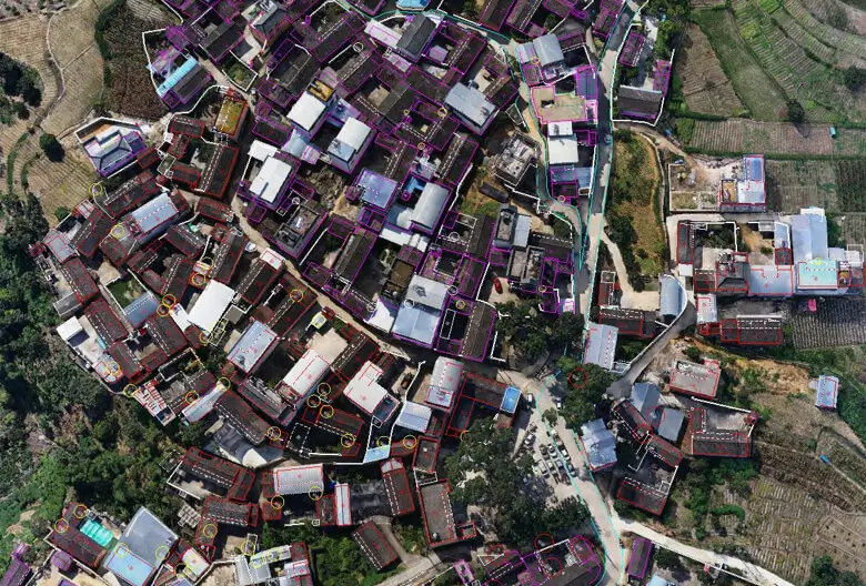
Cadastral Surveys
It quickly generates centimeter-accurate 3D reality models.
AEC and topographic survey
Manage the entire project lifecycle with 2D and 3D drone data.
Natural resource management
Measures, classifies or determines the ownership of water bodies and forests.
Geological survey
Safely collect millimeter-accurate aerial data of geologically hazardous sites.
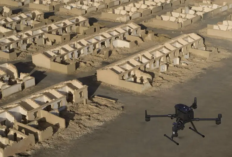
Modeling of disaster sites
Get real-time overviews of vast areas affected by disasters to help teams make critical decisions.
Call Us Now
for a free consultation on Hardware,
Software, and ENAC.
Book Now
your free phone consultation with our Experts.